
History
The original inhabitants of this area were the Potawatomie Indians. They were hunters and fishermen in addition to growing corn and other plants. Early French trappers in the area reported they played a good game of lacrosse with up to 20 on a team.
The county of Lake was formed in 1839 by splitting off from McHenry County. The population was 2,634 when the county was formed.
One of the early settlers was Tobias Wynkoop who gave present day Bull Creek its first English language name. It was originally called Wynkoop’s Creek. The Wynkoop cabin appears to have been near the present site of the Brookhill subdivision along today’s Milwaukee Road and encompassed 4000 acres. Tobias eventually sold off all his lands when he was not able to cultivate more than 90 of the acres. The creek was renamed for the first township supervisor, J. William Bull. (For a fascinating, but long, discourse on how Bull acquired the land from Wynkoop review this law book court decision. You may need to search for “Wynkoop” within the document as it contains many other cases.)
Original owner: William Saroyan Bull (sometimes known as B.S. Bull) Son: was a vaudevillian – stage name “Laugha-bull” Bull Creek: Our tributaries are part of the Bull Creek / Bull’s Brook Watershed (BCBB). The main channel starts above Loch Lomond Lake, runs through St. Mary’s Lake and then Butler Lake before joining our branch and emptying into the Des Plaines River.
Fascinating Details from Plat Maps
A visit to the Lake County Discovery Museum reveals plat maps of the area back to 1861. These are county records of who owned the land. Below are summaries of the available plat maps. In a few cases, images–or links to images–are provided here.
- 1861 plat map: None of the roads we are familiar with are yet in place other than Milwaukee. Wynkoop Creek and Bull’s Brook are listed with Wynkoop Creek being today’s Bull Creek. Our North Branch of Bull Creek is unidentified. There are only a few landowners – C. T. Bull, E. W. Bull, A. I. Wynkoop, J. Shupe and W. E. Houghton.
- 1873 plat map: Most of Bull’s land sold to J. Locke, P. Davis and S. Wright. Wynkoop is still here and his Creek still named after him.
- 1885 plat map: Milwaukee Road is still the only man-made common reference with today. Almost all the ownership has changed from 1861. Now the names appearing on the map are W.W. Buckley, Martin Lynch, J.J. Davis, J. Lynch, F. Albright and Wm. Sedam. Names on adjoining properties include C.A. Buckley, E. Casey and W. Butterfield. Also of note is the County Poor Farm about where Winchester House was located at the corner of Winchester Road and Milwaukee Avenue.
- 1907 plat map: The Chicago-Milwaukee Railroad is now shown, exactly where the Metra line is today. Once again, the ownership has changed somewhat from the previous map. Owners of these lands were John Lynch, E. Lynch, H. Harvey, Henry Boysen, Lela McAtee, Fred Albright and E. Davis. Additional roads are beginning to appear but are not named on the map. They coincide with today’s Casey and Buckley Road; Butterfield Road and Lake Street. The map shows schools along Casey Road and also near today’s Butterfield and the railroad tracks.
- 1920 plat map: Area landowners include R. Swift, A.N. DeVault, Chas. Ware and V.P. Carpenter.
- 1926 plat map: Owners listed now include Dr. A. DeVault, R. Swift, Chas. Ware, Viola Carpenter and Lillian Merrill.
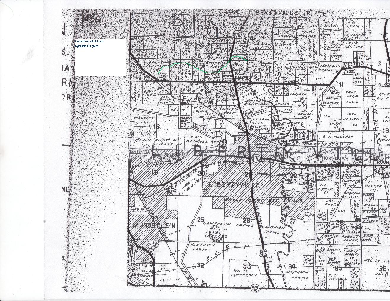
1936 Plat map from the Lake County Dunn Museum
- 1936 plat map: This plat map shows the Libertyville Country Club taking up most of the land of Country Club Estates, Bull Creek and Bull Creek West. The Wood Hollow land was owned by F.J. Just. Also listed are R. Swift and A.N. DeVault along Countryside Drive. We also see the first listing for the Leesley Brothers in separate locations where today we have Timber Creek and the Sports Complex. Interestingly, Milwaukee Road was then Highway 172, while Buckley was listed as Highway 45 with it curving to the north and west as it does today.
- 1954 plat map: The Leesley Brothers are still surrounding our subdivisions. Now the DeVault property has become C.L. Casper; and the Swift property has become P. Bosworth. The whole of the former Libertyville Country Club is now listed as “subdivision”. Another change is Buckley Road being labeled 137 from the east up to Milwaukee Ave (which is called 63); west of that, Buckley becomes 21. Brookhill Park subdivision is noted along Milwaukee Road. The Clavy Nursery is shown just to the north of Leesley along today’s 137 road.
- 1960 plat map: We now have Countryside Drive, Valley and Country Courts shown. Most everything else is owned by the First National Bank of Lake Forest.
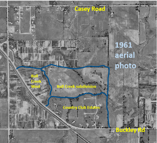
1961 Aerial View
- 1967 plat map: virtually no change, but Country Club Estates identified as such. And
for the first time the ComEd right-of-way for the high-tension lines are marked out.
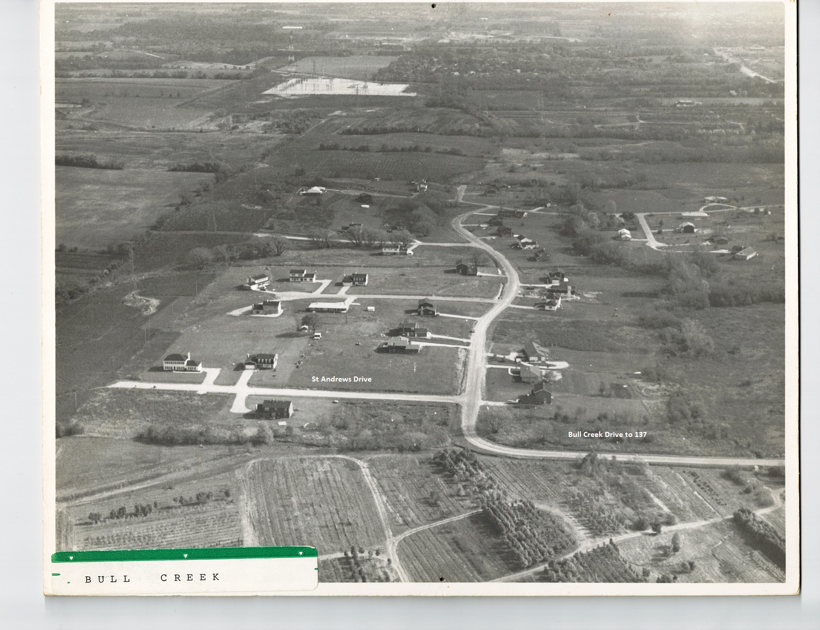
1973 Aerial View
- 1979 plat map: The entire subdivision of Bull Creek now shown up to and including St. Andrews. Label on the creek for the first time says “Bull Creek” for the creek name. (Of interest is that today’s Independence Grove is labeled the Catholic Youth Organization – apparently a summer camp.)
- 1986 plat map: Leesley and Wood Hollow built out. The Clavy Nursery area is now listed as Chicago Title and Trust.
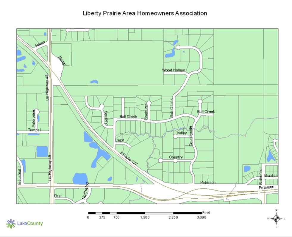
1973 Aerial View
Sources of information:
http://www.lakecountyil.gov
http://www.accessgenealogy.com/native/Illinois
